Ahvaz County
Ahvaz County
Persian: شهرستان اهواز | |
|---|---|
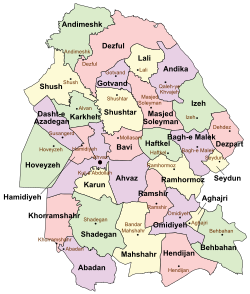
 Location of Ahvaz County in Khuzestan Province (center, purple) | |
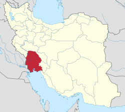
 Location of Khuzestan Province in Iran | |
| Coordinates: 31°19′N 48°40′E / 31.317°N 48.667°E[1] | |
| Country | Iran |
| Province | Khuzestan |
| Capital | Ahvaz |
| Districts | Central, Esmailiyeh, Gheyzaniyeh |
| Population (2016)[2] | |
| • Total | 1,302,591 |
| Time zone | UTC+3:30 (IRST) |
Ahvaz County (Persian: شهرستان اهواز) is in Khuzestan Province, Iran. Its capital is the city of Ahvaz.[3]
History
[edit]After the 2006 National Census, Anaqcheh Rural District and Bavi District were separated from the county in the establishment of Bavi County, which was divided into two districts of two rural districts each, with the city of Mollasani as its capital.[4]
After the 2011 census, Hamidiyeh District was separated from the county to form Hamidiyeh County, which was divided into two districts of two rural districts each, with Hamidiyeh as its capital and only city.[5] Kut-e Abdollah and Soveyseh Rural Districts were separated from the county in the establishment of Karun County, which was also divided into two districts of two rural districts each, with Kut-e Abdollah as its capital and only city at the time.[6] Gheyzaniyeh and Mosharrahat Rural Districts were separated from the Central District in the formation of Gheyzaniyeh District. Esmailiyeh Rural District was separated to form Esmailiyeh District, which was divided into two rural districts, including the new Esmailiyeh-ye Jonubi Rural District.[7] The village of Elhayi was elevated to the status of a city.
Demographics
[edit]Population
[edit]At the time of the 2006 census, the county's population was 1,317,377 in 274,296 households.[8] The following census in 2011 counted 1,395,184 people in 351,980 households.[9] The 2016 census measured the population of the county as 1,302,591 in 362,480 households.[2]
Administrative divisions
[edit]Ahvaz County's population history and administrative structure over three consecutive censuses are shown in the following table.
| Administrative Divisions | 2006[8] | 2011[9] | 2016[2] |
|---|---|---|---|
| Central District | 1,187,340 | 1,348,282 | 1,260,817 |
| Anaqcheh RD[a] | 22,692 | ||
| Elhayi RD | 17,074 | 22,388 | 53,008 |
| Esmailiyeh RD | 48,235 | 33,933 | |
| Gheyzaniyeh RD | 11,636 | 11,692 | |
| Kut-e Abdollah RD[b] | 91,299 | 89,477 | |
| Lami RD | 18,042 | 15,370 | |
| Mosharrahat RD | 7,651 | 40,882 | |
| Soveyseh RD[b] | 18,910 | 19,847 | |
| Ahvaz (city) | 969,843 | 1,112,021 | 1,184,788 |
| Elhayi (city) | 7,651 | ||
| Bavi District[a] | 81,665 | ||
| Mollasani RD | 7,129 | ||
| Veys RD | 23,322 | ||
| Mollasani (city) | 13,979 | ||
| Sheyban (city) | 23,211 | ||
| Veys (city) | 14,024 | ||
| Esmailiyeh District | 17,155 | ||
| Esmailiyeh-ye Jonubi RD | 7,074 | ||
| Esmailiyeh-ye Shomali RD[c] | 10,081 | ||
| Gheyzaniyeh District | 24,613 | ||
| Gheyzaniyeh RD | 11,938 | ||
| Mosharrahat RD | 12,675 | ||
| Hamidiyeh District[d] | 48,372 | 46,902 | |
| Jahad RD | 6,756 | 6,003 | |
| Karkheh RD | 10,189 | 9,580 | |
| Tarrah RD | 9,450 | 10,337 | |
| Hamidiyeh (city) | 21,977 | 20,982 | |
| Total | 1,317,377 | 1,395,184 | 1,302,591 |
| RD = Rural District | |||
See also
[edit]![]() Media related to Ahvaz County at Wikimedia Commons
Media related to Ahvaz County at Wikimedia Commons
Notes
[edit]- ^ a b Transferred to Bavi County[4]
- ^ a b Transferred to Karun County[6]
- ^ Formerly Esmailiyeh Rural District
- ^ Transferred to Hamidiyeh County[5]
References
[edit]- ^ OpenStreetMap contributors (21 July 2023). "Ahvaz County" (Map). OpenStreetMap (in Persian). Retrieved 21 July 2023.
- ^ a b c "Census of the Islamic Republic of Iran, 1395 (2016)". AMAR (in Persian). The Statistical Center of Iran. p. 06. Archived from the original (Excel) on 21 October 2020. Retrieved 19 December 2022.
- ^ Habibi, Hassan. "Approval of the organization and chain of citizenship of the elements and units of the national divisions of Khuzestan Province, centered in the city of Ahvaz". Islamic Parliament Research Center (in Persian). Ministry of Interior, Political and Defense Commission of the Government Board. Archived from the original on 17 July 2014. Retrieved 25 January 2024.
- ^ a b "With the approval of the government and according to the proposal of the Ministry of Interior, four new cities of Duzeh, Asir, Jannat Makan and Hamashahr and two counties of Bavi and Basht were added to the map of the country's divisions". DOLAT (in Persian). Ministry of Interior, Board of Ministers and Political and Defense Commission. 19 June 2010. Archived from the original on 26 March 2017. Retrieved 4 November 2023.
- ^ a b Rahimi, Mohammadreza (29 September 2013). "Country divisions with the approval of the government board: The map of country divisions was changed in some counties". Tasnim News (in Persian). Ministry of Interior, Cabinet of Ministers. Archived from the original on 21 February 2014. Retrieved 17 April 2023.
- ^ a b Rahimi, Mohammad Reza (14 March 2014). "Approval letter regarding country divisions in Khuzestan province". Islamic Parliament Research Center (in Persian). Ministry of Interior, Board of Ministers. Archived from the original on 4 March 2016. Retrieved 3 August 2023.
- ^ Rahimi, Mohammadreza (15 January 2013). "Approval letter regarding country divisions in Khuzestan province" (PDF). RRK (in Persian). Ministry of Interior, Political and Defense Commission. Archived from the original (PDF) on 4 November 2023. Retrieved 4 November 2023.
- ^ a b "Census of the Islamic Republic of Iran, 1385 (2006)". AMAR (in Persian). The Statistical Center of Iran. p. 06. Archived from the original (Excel) on 20 September 2011. Retrieved 25 September 2022.
- ^ a b "Census of the Islamic Republic of Iran, 1390 (2011)". Syracuse University (in Persian). The Statistical Center of Iran. p. 06. Archived from the original (Excel) on 18 January 2023. Retrieved 19 December 2022.

